Following on from my gridded soil sampling which was conducted on my study sites during January, these analysis results have been returned. The samples were analysed at my project’s case partner laboratory. Results on soil pH alongside the nutrient status of phosphorus, magnesium, sulphur and potassium were analysed.
As my soil sampling regime was conducted on a 35m grid basis this type of sampling gives highly specific information on the nutrient status at various points across the field. Typical soil sampling regimes operate on a W pattern and miss the spatial variability existing across fields.
These soil results were transferred into ESRI’s software of ArcMap to allow functions of interpolation by ordinary kriging to produce soil nutrient status maps. These maps are vital to understand how nutrient values alter across the field and to identify potential management zones. As zones of nutrient hotspots and areas of nutrient deficiency can now be visualised it is now possible to analyse this data in relation to other characteristics such as slope and potential nutrient transfer pathways. This is important in order to understand the means by which waterway nutrient enrichment may be occurring and to identify areas of land which do not require further fertilisation based upon the nutrient status of the field. By limiting the excessive application of slurry and fertilisers, the risk of nutrient transfer off-site can be reduced whilst ensuring the soil status is at optimum values for the agricultural purpose it is intended for.
From the soil nutrient maps which I have produced, a range of proposed management methods can now begin to be introduced at each of my sites in order to attempt to improve water quality. These methods are site specific depending upon the range of issues present at each site. Some techniques to be introduced include reducing slurry applications/targeting to specific areas of the field only, introducing experimental willow plantation plots, soft engineering methods of bank stabilisation and the introduction of riparian fencing to reduce livestock poaching of waterways. Alongside establishing these techniques, includes setting up a hydrological monitoring scheme through using an autosampler and time-integrated sediment sampler tubes. However, unfortunately with the current situation with COVID-19, these plans have had to be on hold for a period.
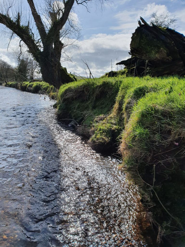
Instead I am focussing on performing some geostatistical analysis on my soil data to further analyse any existing spatial patterns. However, before the change in my working style, in conjunction with AFBI, sampling was also performed on each of the riverbanks at the field sites. This was conducted at areas showing active bank erosion or areas where livestock access has poached the riverbank in order to quantify the potential for nutrient transfer from these areas. Alongside this riverbank sampling, drone flights have also been conducted using the QUB based Centre for Geographic Information Science and Geomatics. These will be useful to produce high resolution imagery as well as LiDAR data for each of the sites for further analysis, ideally I aim to build up a record of imagery spanning several seasons and events for each of the sites to analyse changes in runoff pathways.
Ideally once things have settled down to a more normal way of life, I’ll be able to get back out into the field to continue collecting data and begin to put theory into practise!